
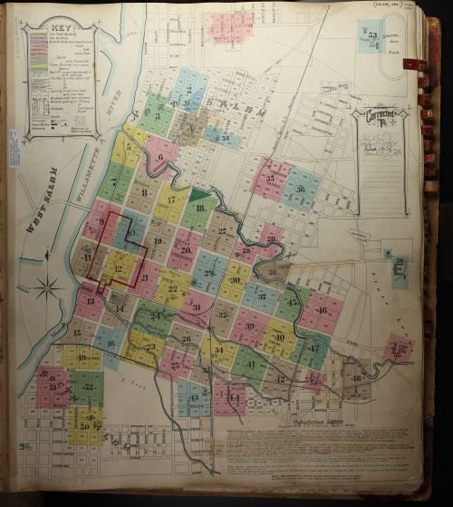
The Willamette Heritage Center has put a 111-year-old map of Salem online for anyone to explore.
The 1915 Sanborn-Perris Fire Insurance Map was digitized in November 2026 and posted on the center's website, according to the Heritage Center. The Sanborn maps listing page describes the 1915 edition as free access through the WHC website. The map was first printed in 1895 and updated through April 15, 1915, showing Salem's streets, buildings and waterways as they existed on that date.
The map has traveled through several Salem institutions. It started in the State Library of Oregon's collections, was withdrawn and transferred to the Hugh Morrow Collection at the Salem Public Library. In 2011, the Willamette Heritage Center took over preservation of the book under a Held in Trust agreement with the City of Salem.
Sanborn fire insurance maps were created to help insurance companies set rates for policyholders. They detail building construction with color coding: pink marks brick, yellow marks wood. The Sanborn company even sent stickers to map holders so they could update their copies when properties changed, according to the Heritage Center's Sanborn Maps page.
The 1915 map joins a broader collection at the center. Salem Sanborn maps date back to April 1884, with editions from 1888, 1890, 1895, 1926–1927, 1951, 1958, 1963, 1965 and 1966. Several earlier maps are available digitally through the Library of Congress. The 1926–1927 and 1951 editions can be accessed free through the ProQuest database with a Salem Public Library card.
Physical copies of Sanborn maps in the Heritage Center's collections are available free by appointment. Residents can schedule a visit through the center's library and archives page. The center's Couch Historian webisode series includes an episode with tips on accessing and reading the maps.
Salem Public Library cardholders can access the ProQuest Oregon Sanborn Maps database through the library's online resources page at cityofsalem.net.